
In 1912, the Titanic sank. Due to technological limitations and high costs, it took more than 70 years for scientists to find the wreck. Nowadays, it's easier. We'll show you where the Titanic is and how to find it on Google Maps.
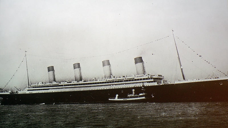
On April 14, 1912, the British passenger ship RMS Titanic hit an iceberg in the North Atlantic. More than 1,500 passengers and crew members died in the collision. Even more than 100 years after the ship sank, the fascination and interest in the events is still great.
Sinking of the Titanic: What happened then?
The RMS Titanic was on its maiden voyage from Southampton, England, to New York City when the collision occurred. The largest ship in the world at the time had almost reached its destination. The Titanic sank just 715 miles from the port of Halifax in Canada and just 1,250 miles from New York City. It had less than three days at sea.
The incident made it one of the most famous ships in history. Many secrets, myths and conspiracy theories have since surrounded the events of that night. The exact location of the accident remained a mystery for a long time.
It was not until 70 years after the collision that an expedition led by Robert Ballard found the wreck of the Titanic on September 1, 1985. The fact that the search took so long was not only due to the ship's difficult position. It is located at a depth of about 3,800 meters in the North Atlantic, about 600 kilometers southeast of Newfoundland. The exact coordinates at the time of the sinking were also not known because the navigation technology at the time was not precise enough.
Overall, people were extremely limited in their search: the technology for searching and exploring the deep sea was not yet very advanced. There were no sonar or underwater cameras that could help locate the wreck. This made the search extremely complex and expensive. Nowadays, it is much easier to find the shipwreck.
On Google Maps: Where is the Titanic?
Because nowadays you only need access to the Internet to locate the Titanic. Using Google Maps or Google Earth, simply enter the following coordinates: 41.7325° N, 49.9469° W.
Now you can explore the area where the iceberg was when the Titanic collided with it. According to media reports, the exact location of the sinking is about 21 kilometers from the vague coordinates given by the Titanic's radio operators on the night of the accident.
Tourist diving trips to the wreck of the Titanic have also been taking place for about two decades. However, interested parties have to pay about 250,000 US dollars for this. In June 2023, the five occupants of a submersible that was supposed to take them to the wreckage of the ship died on such a trip.
Also interesting:
Source: https://www.basicthinking.de/blog/2024/07/20/wo-liegt-die-titanic-google-maps/