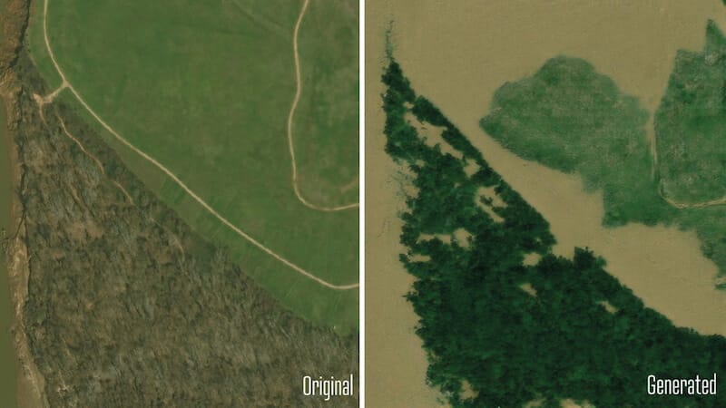
Researchers have developed an AI tool that can predict flood disasters using satellite images. The system is intended to help visualize storms in order to prepare for them.
Will it soon be possible to predict flood disasters precisely? Researchers at the Massachusetts Institute of Technology (MIT) are pursuing this goal. They have developed a method that uses artificial intelligence (AI) to create realistic satellite images of possible flood disasters. This should enable those affected to prepare better.
The system combines AI that can generate images with physical models that calculate how water behaves during a storm. The researchers tested their method on images of Houston during Hurricane Harvey in 2017. The result: The generated images looked deceptively real and were more accurate than pure AI models because physical laws were taken into account.
AI can predict flood disasters – here's how it works
The heart of the method is a so-called “Generative Adversarial Network” (GAN). This model works with two neural networks: one generates images, the other checks whether they are realistic. In this way, both learn to deliver ever better results. But pure GANs have a weakness: they can create “hallucinations” – false details such as floods in places where there could be none.
To avoid this, the team coupled the AI with a physical flood model. This model takes into account important factors such as the path of the storm, wind strength and local infrastructure. This creates images that are realistic and reliable.
Realistic satellite images of floods
Floods are often represented by colored maps that mark elevations and danger areas. But many people cannot interpret such cards well. Realistic satellite images are much more vivid and emotionally tangible.
This could encourage people to act in a timely manner – for example to evacuate. In the long term, such AI-generated images could help with disaster planning. Communities could better communicate potential risks and decision-makers would have a reliable basis for evacuations or protective measures.
The researchers hope that their technology will one day be used worldwide to save lives and minimize damage. The method can already be tried out online.
Also interesting:
Source: https://www.basicthinking.de/blog/2024/12/03/realistische-satellitenbilder-von-ueberschwemmungen/


